
EXPLORE EQUITY IN YOUR CITY
In an equitable city, everyone experiences the same level of beneficial environments.
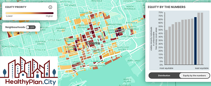
HealthyPlan.City combines built environment datasets from different sources with demographic data from the Canadian Census to present a picture of environmental equity in urban areas for 129 cities across Canada. The data used in this tool covers municipalities in Canada with a population of over 30,000 individuals. Urban boundaries are established by Statistics Canada and are based on Census Subdivisions, which provide the administrative boundaries of all municipalities across Canada. Data is mapped for areas with a population density of 400 people per square kilometer or more. The geographic area covered by the HealthyPlan.City tool is home to 24,618,003 people.
For much more information covering Demographic Data, Built Environment Data, Equity Priority, Distribution, Neighbourhoods and a full list of communities in Canada included in this tool, follow this link =>
This tool deserves to be in permanently included in our resources pages for the future reference.
Leave a Reply